Geologic Mapping with ArcGIS
A self-paced ArcMap tutorial for geologists
View tutorial PDF Download tutorial data .zip
Duration: Oct 2019 - Dec 2019
Affiliation: Stanford Geospatial Center
What: GIS tutorial (instructions and test data)
My Role: Tutorial author
The Task:
The Stanford Geospatial Center offers a few introductory GIS workshops, focusing on raster and vector operations. But the Director of Field Education at the Stanford School of Earth approached me about creating a “second step” workshop for its geology students. The target audience of the workshop would be students who’d created detailed field notes or handdrawn geologic maps, but wished to create a digital version and had only introductory GIS knowledge.
My Approach:
I relied heavily on my previous geology education to distill the tutorial to the most common and/or most important features. “What items might I sketch on a paper map that I’d need to include digitally?”
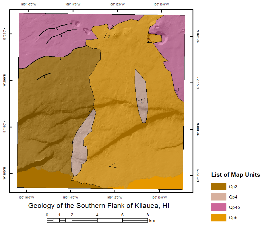
To make mapping as “plug and play” as possible, and to help students create a map easily understood by other professionals, I based my tutorial on the NCGMP09 geologic mapping standard, a standardized set of symbols for geologic features developed by the USGS National Cooperative Geologic Mapping Program. (NOTE: This tutorial was written prior to the 2020 adoption of GeMS as USGS’s new standardized geologic map schema.) My instructions teach students how to download this map template in the form of a geodatabase, and how to enter their field data into the feature classes of the template.
I also didn’t want to totally re-invent the wheel: the tutorial is partially based on a short course (zip file, 322MB) by Ralph Haugerud (USGS) and workshop material created by Roman DiBiase and Erin DiMaggio (Penn State Geosciences).
Outcome highlights:
The tutorial constructs a hypothetical geologic map of a site regularly visited by Stanford’s Wrigley Field Program, tracing geologic contacts based on aerial imagery and field observation points.
Some topics covered include:
- Creating subtypes within feature classes and setting default attribute values for new features
- Adding XY data collected from a field GPS unit
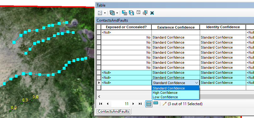
- Creating topology files that mirror the rules of geologic mapping and checking for topology errors within a geodatabase
- Using cartographic representation files to simplify map symbology
- Making VBScript expressions for custom feature labels
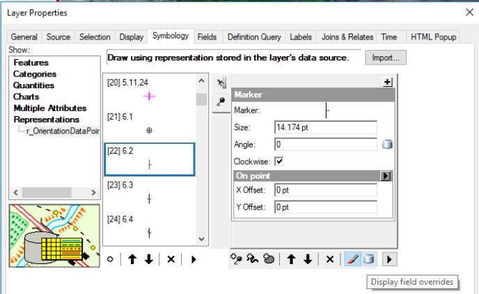
- Systematically rotating point symbols based on a “degrees” attribute field (i.e. strike and dip markers)
- Introduce users to USGS mapping and symbology standards