Tutorial - Historical Web Mapping
A guide to using the David Rumsey Map Collections in digital humanities projects
View 1st tutorial PDF View 2nd tutorial PDF
Duration: Oct 2019 - Dec 2019
Affiliation: David Rumsey Map Center
What: Tutorial series for Map Center patrons, primarily academics
My Role: Tutorial author
The Task:
The David Rumsey Map Collection is widely accessed not only at its physical home at Stanford University but by people around the world. The Map Center staff wished to create a guide for geospatial novices who want to use maps from the Rumsey collection for their own digital mapping projects.
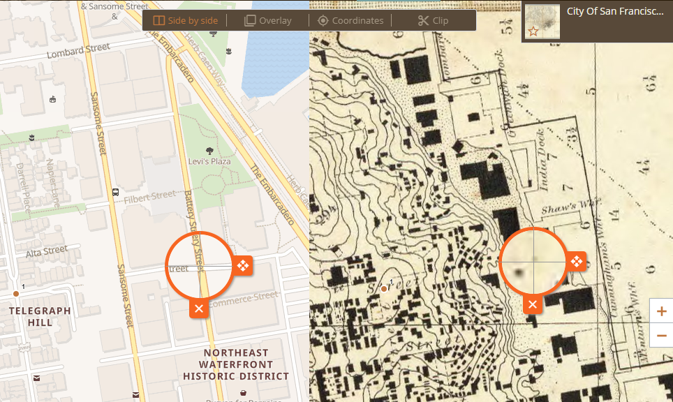
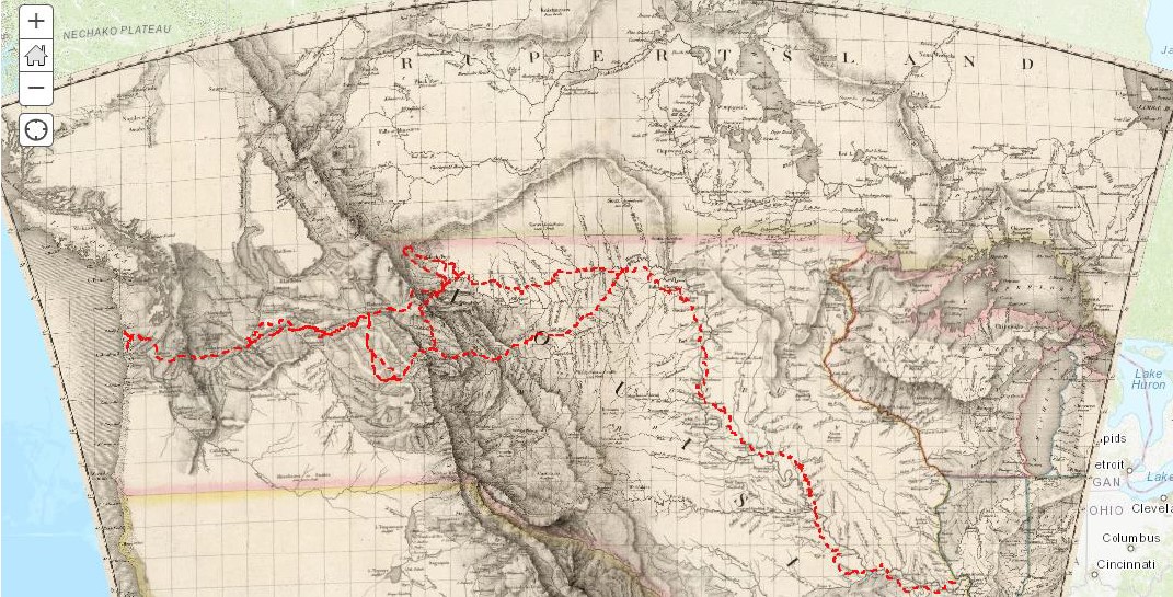
In addition to an ArcGIS Online tutorial specific to using Rumsey maps, the Map Center desired a tutorial on using the Georeferencer platform. Though many georeferencing tools exist, DavidRumsey.com integrates with Georeferencer, a web service by Klokan Technologies. The platform enables “crowdsourced” georeferencing of thousands of maps in the collection.
My Approach:
I split this initiative into a series of three sequential tutorials that can be self-paced or taught live.
- Tutorial #1 demonstrates how to georeference digitized Rumsey maps online;
- Tutorial #2 demonstrates how to import these maps into ArcGIS Online straight from DavidRumsey.com;
- Tutorial #3 is a fairly standard introduction to creating symbology and popups in an AGO webmap.
Many of the patrons who use the center are historians and humanists, who may not have much experience in the digital humanities. While there are multiple techniques for approaching the task (the art?) of georeferencing, I tried a bunch of different approaches myself to narrow in on what methods would seem the most intuitive given the quirks of the platform(s) used.
Outcome highlights
- Wrote instructional material for a non-technical audience, assuming no prior geospatial knowledge
- Refined and illustrated a work flow to make numerous platforms and services work together, including Georeferencer, LUNA viewer (on DavidRumsey.com), web map tile services (WMTS), ArcGIS Online community data, and custom user shapefiles
- Crafted an annoted “teacher’s edition” of each tutorial, to help other Map Center employees run the workshops after my departure from the Center
- Created some “rules of thumb” that indicate when one is done georeferencing an image and that help interpret the georeferencing quality metrics provided by Georeferencer.